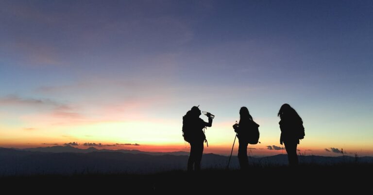
In a world where horizons for exploration seem increasingly limited, the mountains continue to represent a fascinating challenge and a refuge for those seeking adventure far from the hustle and bustle of everyday life. Climbing to over 3,000 meters means entering a world where the air is thin, where landscapes reveal a raw, sometimes untamed beauty. In France, these imposing peaks offer a bridge between intense physical exertion and the contemplation of extraordinary panoramas, between the living history of mountaineering and modern hiking practices. This overview of the five emblematic peaks to explore highlights a major challenge: how to combine a passion for nature, respect for fragile spaces, and hiker safety in a rapidly changing climate and environmental context. Here is a dynamic guide to fuel this quest, blending technical rigor and wonder, and to better understand the riches and challenges of these mountains, which peak well above 3,000 meters. Mont Buet: Discover a Wild and Accessible Summit in the Heart of the Alps
Mont Buet, perched at 3,096 meters, is one of the jewels of Haute-Savoie, often nicknamed the “Mont Blanc des Dames” (Ladies’ Mont Blanc) due to its imposing face, yet accessible to seasoned hikers. Contrary to the image one might have of a mountain reserved for technical climbers, this summit offers a route that is both rich in diversity and demanding in endurance, nestled between thick forests, verdant pastures, and a final, very distinctive rocky area.
The departure point, located in the charming village of Le Buet, marks the beginning of an adventure that gradually climbs towards the Col de Salenton. This passage opens the door to an alpine landscape with a view that encompasses the entire massif, encompassing the French and Swiss Alps in a single glance. The climb to the summit requires special attention to avoid scree and ensure proper progress on stony and sometimes unstable terrain. However, for those with solid mountain experience, the effort is rewarded with an exceptional panoramic view of the Alps. 🌟Total distance
: approximately 16 km round trip
- ⛰️ Elevation gain : approximately 1,500 meters
- 🏞️ Required skill level : experienced hiker
- 🎒 Points of interest : forests, pastures, rocky area
- For those who enjoy climbing, it is crucial that Mont Buet not be underestimated. Physical preparation must be rigorous, and the right equipment (sturdy hiking boots, wind protection, and a water supply) is essential. In 2025, weather conditions in the Alps are increasingly unpredictable, making it essential to consult weather reports and local advice. Caution, combined with a good knowledge of the routes, ensures a memorable high mountain experience. Characteristics of Mont Buet 🏔️ Details
Altitude
| 3,096 meters | Region |
|---|---|
| Haute-Savoie | Hiking time |
| 6 to 8 hours | Accessibility |
| Marked trail for experienced hikers | Risks |
| Rockfalls, changeable weather | Discover the majesty of the mountains, their breathtaking landscapes, their unique biodiversity, and the outdoor adventures that await you. Explore the peaks, hikes, and natural beauty that make the mountains a must-see destination for nature lovers and adventurers. |
| Assaulting the Aiguille de la Grande Sassière: an iconic summit of the Graian Alps | At 3,747 meters, the Aiguille de la Grande Sassière presents a challenging challenge in the heart of the Graian Alps. This summit is distinguished by its impressive vertical walls and the immense glacier that embraces its flanks, a true exploration area for experienced hikers and mountaineering enthusiasts without heavy technical equipment. |


Total distance
: approximately 12 km round trip ❄️Elevation gain
: approximately 1,300 meters
- ⚠️ Required skill level : Experienced hiker in alpine terrain
- 📍 Points of interest : Sassière Glacier, rock faces
- The end result of this climb is a magnificent panorama encompassing the Alps, between sparkling landscapes and majestic peaks. Due to climate changes affecting glaciers, it is essential to prioritize technical preparation and follow official guidelines to avoid accidents. Moderate mountaineering experience, supported by suitable equipment, makes this hike an accessible and challenging feat. Characteristics of the Aiguille de la Grande Sassière 🗻 Details Altitude
- 3,747 meters Massif Graian Alps
Duration
| 5 to 7 hours | Recommended Equipment |
|---|---|
| Crampons, ice axe | Risks |
| Ice, unstable scree | https://www.youtube.com/watch?v=vOrU2qQDw8I |
| Mont Chaberton: panorama and history from the summit of Les Cerces | Rising to |
| 3,131 meters | Mont Chaberton, located in the Cerces massif, is a summit where exploration and history intersect. In addition to its magnificent alpine landscapes, this mountain boasts a military past, with the old military fortress overlooking the surrounding area, a reminder of the strategic challenges of yesteryear. Today, hiking to this summit combines cultural discovery and personal challenge. |
| The route, accessible from Montgenèvre, offers a path through refreshing coniferous forests and sunny mountain pastures, before the final climb over rocky terrain that requires caution but not technical climbing skills. The panoramic view of the French and Italian Alps attests to the magnitude of the site, with the expanses of the French Alps on one side and the Italian border on the other. 🚶♀️ | Total distance |

🥾
Elevation gain : approximately 950 meters🌿
Required level
- : experienced but accessible hike 🛤️ Points of interest
- : historic fortress, forests, mountain pastures A real challenge for some, this climb proves to be a complete route for enthusiasts looking to combine nature, history, and a sporting challenge. Bring suitable equipment, water, and anticipate the region’s frequent weather changes. Mont Chaberton is an ideal destination for a hiking trip that is both rich in content and safe for experienced mountaineers. Characteristics of Mont Chaberton 🏔️ Details
- Altitude 3,131 meters Location
- Massif des Cerces Duration 4 to 6 hours
Accessibility
| Well-marked trails, partly rocky terrain | Special Interest |
|---|---|
| Remains of a military fortress | Discover the beauty of the mountains, a world of breathtaking landscapes, outdoor adventures, and inner peace, where each peak reveals spectacular panoramas and unforgettable experiences. |
| Alpine Getaway to the Pic du Mas de la Grave, a Panoramic Summit in the Hautes-Alpes | At 3,020 meters, the Pic du Mas de la Grave attracts visitors with its strategic location north of the Écrins National Park, where the panoramas span three countries: France, Italy, and Switzerland. This territorial duality enriches the hiking experience with the diversity of the landscapes, combining classic mountaineering with an immersive journey into the wilderness. |
| Starting from Serre-Chevalier, the route passes through fragrant mountain pastures, Serpent Lake, and then rocky sections that require attention but no technical climbing. The route, although steep at times, is accessible to well-prepared hikers with a good knowledge of natural spaces. The ascent demands a complete experience, combining effort, contemplation, and respect for a fragile environment. 🚩 | Total distance |
| : approximately 14 km round trip | ⛰️ |
| Elevation gain | : approximately 1,100 meters |

Vous avez un projet spécifique ?
Kevin Grillot accompagne entrepreneurs et PME en SEO, webmarketing et stratégie digitale. Bénéficiez d'un audit ou d'un accompagnement sur-mesure.
Required skill level
: experienced hikers 🌄Highlights
: Serpent Lake, views of three Alpine nations
- Particularly sensitive to climate variations, the region requires serious preparation. We’ll focus on the need to bring suitable clothing, sufficient supplies, and master the basics of mountain safety. Caution is essential for a climb that offers a true sensory journey, where nature reveals itself in all its magnificence. Characteristics of the Pic du Mas de la Grave 🏞️ Details Altitude
- 3,020 meters Region Hautes-Alpes
- Estimated duration 6 to 8 hours Accessibility
- Varied trail, no climbing Challenges Environmental protection, weather
| Tête de la Fréma: the ultimate challenge between France and Italy | Perched at |
|---|---|
| 3,151 meters | The Tête de la Fréma stands out as a symbolic summit on the French-Italian border in the Alpes-de-Haute-Provence region. This mountain presents a considerable challenge, not only due to its altitude but also its steep topography, which requires endurance, experience, and respect for mountain conditions. |
| The trail begins in the Ubaye Valley, an area offering a natural setting rich in biodiversity and picturesque landscapes. The trail climbs through forests and mountain pastures, then takes in more complex rocky passages, although it does not require any technical climbing. Careful progress is essential to complete this final stage before the final ascent. 🔥 | Distance |
| : approximately 18 km round trip | 💪 |
| Elevation gain | : approximately 1,300 meters |
| 🎯 | Recommended level |

🌐
Features : steep trails, diverse ecosystemsThe weather conditions at these altitudes are a real challenge, quickly changing the balance between safety and risk. The use of modern navigation tools, combined with a detailed knowledge of the local environment, ensures a safe hike. This demanding climb is a constant adventure, fully embodying the desire to travel to summits where time seems to stand still. Features of Tête de la Fréma 🏔️
Details
- Altitude 3,151 meters Location
- Alpes-de-Haute-Provence Distance 18 km round trip
- Elevation 1,300 meters Complexity
- Steep trails, rocky passages Discover the majestic beauty of the mountains, from snow-capped peaks to lush green landscapes. Embark on an adventure along hiking trails, explore unspoiled regions, and let yourself be captivated by the tranquility of nature. Embark on an unforgettable experience in the heart of the mountains. Essential preparation tips for conquering Alpine summits
Climbing peaks over 3,000 meters, whether Mont Buet, Aiguille de la Grande Sassière, Mont Chaberton, Pic du Mas de la Grave, or Tête de la Fréma, requires meticulous preparation combining physical fitness, equipment, and knowledge of the terrain. These recommendations appear to be a real escape hatch from the hazards and risks of alpine climbs:
| 🎒 | Key Equipment |
|---|---|
| : sturdy hiking boots, technical clothing adapted to temperature variations, a light but well-equipped backpack | 📍 |
| Navigation | : detailed maps, GPS, or reliable mobile apps to find your way |
| ⚠️ | Weather Monitoring |
| : closely monitor current climate reports and anticipate sudden changes | 💧 |
| Hydration and Nutrition | : bring water and energy-boosting snacks to sustain your efforts |


Respect for the Environment
: prioritize “Leave No Trace” and avoid overuse of trails
- Taking your own endurance level into account is essential. Too often, underestimated hikes turn into dangerous situations. In 2025, given the evolution of the mountains and the growing number of visitors, prioritizing best practices and legal alternatives to discover these peaks is becoming a vital issue. Sharing experiences within hiking communities helps avoid common mistakes and improves collective safety. Preparation Tips ⛑️ Importance
- Suitable equipment Essential for safety and comfort Knowledge of the route
- Reduces the risk of loss and accidents Weather monitoring Indicates the right time to climb
- Physical capacity Ensures the success of the adventure Environmental respect
- Preserves the mountains for future generations Digital tools at the service of modern mountaineering In 2025, the digital world has invaded mountain trails, offering hikers powerful tools to make their expeditions safer. These technologies include smartphone apps providing access to detailed topographic maps, real-time weather alerts, as well as platforms for sharing routes and advice among mountaineering enthusiasts. Furthermore, geolocation systems allow for better emergency response management in the event of an incident.
To this end, evaluating the services offered is essential before any outing: choosing reliable apps, downloading offline maps beforehand, and validating network connectivity in remote areas are all essential precautions. Networks like Komoot (guided alpine exploration) are contributing to this growing digitalization, offering real guides for choosing routes safely.
| Responsible Exploration and Environmental Issues in the French Alps | Discovering Alpine peaks is not just a physical challenge; it is also an act of commitment to nature and the mountains. The fragility of these ecosystems, exacerbated by global warming and the growing influx of tourists, requires more rigorous management of hiking and mountaineering practices. Legal alternatives, such as defined routes in national parks and nature reserves, are a preferred way to avoid soil erosion, disturbance of wildlife, and degradation of flora. |
|---|---|
| Mountain professionals and institutions are implementing awareness campaigns to respect protected areas. Not opening new unpaved trails, avoiding off-trail travel, and systematically cleaning up waste are all good practices to share. These measures ensure a lasting balance between exploration and conservation. | 🌍 |
| Sustainable trail management | : rehabilitation and regular maintenance |
| 🐾 | Biodiversity protection |
| : respect for natural habitats | ♻️ |
| Waste sorting and management rules | : raising awareness among hikers |
🔍
Scientific monitoring
: monitoring impacts on alpine environmentsEnvironmental issues represent a challenge that seriously concerns all those who wish to explore these heights. By cultivating a strong ecological awareness, everyone can contribute to preserving the splendor of these peaks. This approach complements modern technologies, which make hiking safer but does not replace responsible ethics. Environmental Issues 🌿Proposed Actions
Vous avez un projet spécifique ?
Kevin Grillot accompagne entrepreneurs et PME en SEO, webmarketing et stratégie digitale. Bénéficiez d'un audit ou d'un accompagnement sur-mesure.
Soil Erosion
Maintaining Marked Trails
Visual Pollution and Waste
- Collection and Awareness Affected Biodiversity Prohibition of Off-trail Hiking
- Impact of Tourism Regulation of Visitor Flows Overview of French Peaks Over 3,000 Meters: Comparison of Major Features
- To effectively guide your choice of hiking and alpine exploration, here is a comparative table that summarizes the main characteristics of the five peaks presented, providing a quick overview of the differences in altitude, distance, elevation gain, and required skill level. SUMMIT 🏔️ Altitude (m) ⛰️ Round Trip Distance (km) 🚶♂️
- Elevation (m) 📈 Required Level ⚡ Highlights 🌟
Mont Buet
| 3,096 | 16 |
|---|---|
| 1,500 | Advanced |
| Forests, pastures, panoramic views | Aiguille de la Grande Sassière |
| 3,747 | 12 |
| 1,300 | Expert |

Glacier, vertical walls
Mont Chaberton
| 3,131 | 10 | 950 | Advanced | Military remains, panoramas | Pic du Mas de la Grave |
|---|---|---|---|---|---|
| 3,020 | 14 | 1,100 | Advanced | Three countries, Serpent lake | Tête de la Fréma |
| 3,151 | 18 | 1,300 | Advanced | Steep trails, biodiversity | Additional resources for an informed discovery of the summits |
| To deepen your knowledge of the French Alpine peaks and best prepare for your adventures, here are some essential references to consult. These sources offer a variety of content, ranging from historical accounts to practical guides, and contribute to a better understanding of mountaineering and hiking. They also provide insight into the evolution of mountains in the face of contemporary changes: | 📚 | Discover the most beautiful mountain peaks | 🎧 | Podcast “Beyond the Summits” on France Culture | 📖 |
| Women Conquering the Summits – Gallica | 🗺️ | Komoot: Collection of the Great Alpine Peaks | 🌄 | Ma Petite Rando: Peaks Over 3,000 Meters | 🌐 |
| Altituderando: Accessible Alpine Peaks | Content regularly updated in 2025 also highlights new developments in the digital tools used to support these hiking projects. For example, news on | Google scraping/la-polyvalence-du-scraping-un-outil-mille-possibilites/">Marketing 2025 | or | Google scraping/la-polyvalence-du-scraping-un-outil-mille-possibilites/">Marketing announcements | may seem far removed from the topic, but they highlight a significant shift in the way enthusiasts learn and share their experiences. Finally, the rise of media and partnerships linked to artificial intelligence (AI and media) is also significantly changing the dissemination of and access to knowledge about the mountains. |
What contemporary explorers say
To capture the quintessence of alpine adventures, it is interesting to turn to the stories of mountain conquerors.
- This documentary , for example, provides insightful accounts of the evolution of mountaineering and the personal commitment of climbers. The historical and technical richness of these routes confirms the importance of careful preparation and a deep respect for these adventure terrains.
- Frequently Asked Questions About High Mountain Hiking ❓
- When is the best time to climb these peaks? Late spring to early fall is preferable, as weather conditions are more stable and the trails are generally clear. Summer remains the most favorable period for hiking and mountaineering.
- ❓ What equipment is essential for a safe ascent?
- Sturdy footwear, layered clothing to adapt to changing temperatures, trekking poles, and, depending on the peak, ice axe and crampons for glaciers. A first aid kit is recommended. ❓
- Can you undertake these climbs alone? It is advisable not to hike alone, especially for the most technical summits and those on glacial terrain. The mountain network and solidarity allow for better management of unforeseen events. ❓
Are the summits accessible without specific alpine training? Some routes, such as Mont Buet or Mont Chaberton, are accessible to experienced hikers without technical climbing. However, the Aiguille de la Grande Sassière requires suitable equipment and a good understanding of glacial terrain. ❓ How can you respect the environment while hiking? Stay on marked trails, leave no litter, limit noise, and avoid disturbing local wildlife. Respect for nature is a top priority.
Vous avez un projet spécifique ?
Kevin Grillot accompagne entrepreneurs et PME en SEO, webmarketing et stratégie digitale. Bénéficiez d'un audit ou d'un accompagnement sur-mesure.
📋 Checklist SEO gratuite — 50 points à vérifier
Téléchargez ma checklist SEO complète : technique, contenu, netlinking. Le même outil que j'utilise pour mes clients.
Télécharger la checklistBesoin de visibilité pour votre activité ?
Je suis Kevin Grillot, consultant SEO freelance certifié. J'accompagne les TPE et PME en référencement naturel, Google Ads, Meta Ads et création de site internet.

Checklist SEO Local gratuite — 15 points à vérifier
Téléchargez notre checklist et vérifiez si votre site est optimisé pour Google.
- 15 points essentiels pour le SEO local
- Format actionnable et imprimable
- Utilisé par +200 entrepreneurs