In 2025, it’s been exactly two decades since Google Earth offered an unprecedented window onto our planet. From a simple virtual globe to a true environmental monitoring tool, the platform has undergone a meteoric rise. Its recent addition: the time travel feature integrated into Street View, allows users to see the impact of climate change over the decades. This breakthrough not only identifies transformations, but also concretely materializes retreating glaciers, deforestation, and rising sea levels. Partnering with partners like WWF, Greenpeace, and UNEP, this platform has become a true living tableau of ecological disruption. Satellite data, enriched by industrial players such as Air France and Fujitsu, gives a new dimension to awareness and research. Today, Google Earth is no longer limited to simple curiosity to explore the world; it has become an agent of change, a visual witness to the climate emergency. These are all elements that are transforming the way society perceives, understands, and acts on environmental issues. This digital journey, accessible to all, offers a rare opportunity to see in order to act. More than just a tool, Google Earth serves as a lucid mirror of our changing planet. To better understand this metamorphosis, let’s take a deeper look at how this tool is changing our perspective on climate change.
A look back at 20 years of Google Earth: from its emergence to a key platform in the fight against climate change
Since its launch in 2005, Google Earth has quickly established itself as a true digital phenomenon. With over 2 billion searches annually, it’s not just a form of entertainment or a geographical curiosity; it’s also becoming an essential tool for protecting the planet. Initially, the goal was simple: to allow everyone to take a fresh look at the world, like a sailor scanning the horizon. This tool quickly expanded with impressive features, such as the overlay of historical satellite imagery and the creation of animated visualizations, true windows onto the history of our environment.
Here’s a brief summary of this evolution:
- 2005: Official launch, the beginning of a visual revolution. First successes with 100 million downloads in one week.
- 2006: Collaboration with NOAA after Hurricane Katrina to provide updated images of disaster areas. Immediate use for disaster management. 2008:
- Discovery of unexplored coral reefs off the coast of Australia, revealing the tool’s power for research. 2010:
- Identification of fossil caves leading to the discovery of a new hominid species. Science owes him a great deal. 2017:
- Introduction of the Timelapse feature, a synthesis of over 24 million satellite images to visualize the evolution of landscapes over 35 years. This history reveals a constantly evolving platform, ever more relevant for observing the state of the Earth. Now, Google Earth is going even further, positioning itself as a major player in the fight against climate change. The question then becomes how this tool is concretely working to transform awareness and consciousness. The answer lies in its visual experiments, partnerships, and new features, which shed light on crucial issues. In particular, the timeline integrated into Street View, which allows you to go back in time, proves to be a formidable tool. This visual summary of the official history of Google Earth paves the way for a detailed exploration of its capabilities, to better understand their real impact.
Discover the impacts of climate change on our planet, the underlying causes, and the actions we can take to preserve our environment for future generations. Partnerships and collections that bring the fight against climate change to life through Google Earth
Among the flagship initiatives is the Atlas of Our Changing Environment, launched in 2006, which brings together satellite images overlaid over several decades. Here is an overview of the notable sites:
Site
Visible transformation
| Initial year | Changes to 2025 | Gulf of Mexico oil spill | Profound impact on marine life |
|---|---|---|---|
| 2010 | Visible reduction through cleanup and restoration efforts | Deforestation in the Amazon | Progressive disappearance of forests |
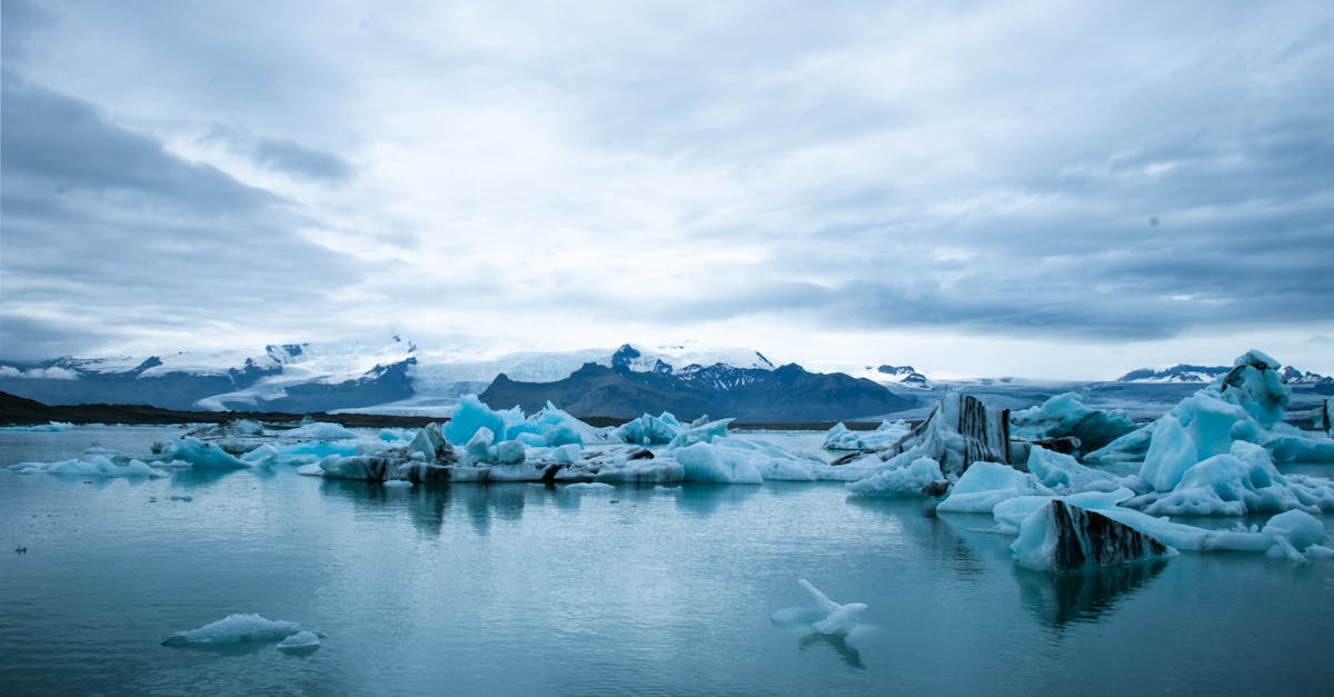
| 2007 | Loss of more than 20% of initial forests | Retreat of Greenland glaciers | Accelerated melting, significant mass loss |
| 1990 | More than 50% retreat by 2025 | Aral Bay | Transformation of a lake into a salt desert |
| 1973 | One of the most blatant sculptures of climate change | Vegetation in South Australia | Desert encroachment and loss of biodiversity |
| 2000 | Significant expansion, threat to local wildlife | This system allows the observer to go beyond metrics, by concretely visualizing the damage and the speed at which the planet is changing. Thanks to the power of these tools, NGOs such as VENTU, Biosphera, and agencies like Hertz and SNCF also participate in the collection and dissemination of data. Note that these temporary visions are not just for show. They are used to fuel awareness campaigns and concrete actions. Governments and institutions such as the Ministry of the Environment and universities use this data to develop their resource management and adaptation strategies. The platform thus becomes a space for dialogue between science, politics, and civil society. | Discover the challenges and impacts of climate change on our planet. Learn about the causes, consequences, and solutions for a sustainable future in the face of this global environmental crisis. |
How the time travel feature is reshaping perceptions of climate change
For example, in San Francisco Bay, the progression of urbanization is evident, as is the retreat of beaches. In Patagonia, the melting of glaciers is now visible, making global warming tangible. Consider the impact this can have on urban planners: visualizing with a single click the intensive concreting in wetlands or the loss of vegetation. It becomes an exceptional educational tool for raising awareness among younger generations or for informing communication campaigns. Here are some examples of concrete applications:
Visualizing the disappearance of small abandoned villages in the south of France, witnesses to the effects of climate change.
Monitoring the expansion of urban areas in metropolises like Paris or Mumbai, highlighting their impact on the local environment.
Documenting sea level rise, particularly in vulnerable coastal areas like Florida or Bangladesh.
- Through this approach, Google Earth has become an essential vehicle for raising awareness of the climate emergency on a local and global scale. The ability to simply go back in time profoundly changes the way we perceive the impact of climate change. It’s a concrete, visual, and immediate approach. This technology finally gives everyone the ability to see the planet evolve, measure the impact of their actions, and take the risk of changing their behavior.
- Discover the challenges of climate change, its impacts on our planet, and the actions needed to preserve our future. Learn about sustainable solutions and commit to a better world.
- The scientific and educational impact of Google Earth in the fight against climate change
Scientists, particularly those specializing in climatology and biology, use Google Earth as a central research tool. Thanks to its rich visual data, they analyze melting glaciers, deforestation, and desertification. The platform allows for instant visualization of the evolution of certain phenomena, thus avoiding lengthy and costly studies. A recent 2025 study indicates that using Google Earth has accelerated data collection by 30% in several climate projects. The ability to compare images from one decade to the next also facilitates modeling and forecasting.
Vous avez un projet spécifique ?
Kevin Grillot accompagne entrepreneurs et PME en SEO, webmarketing et stratégie digitale. Bénéficiez d'un audit ou d'un accompagnement sur-mesure.
To further enhance understanding, Google Earth recently expanded its tools with interactive modules, allowing users to go beyond simple observation. Experts in biodiversity and risk management are designing dynamic visualizations to show, for example, the progression of deforestation in the Amazon or the retreat of the ice cap at the North Pole. Here is a summary of the scientific impact:
scraping/lart-de-la-data-a-votre-portee-comment-le-web-scraping-peut-transformer-votre-entreprise/">Application
Contribution
Main users
Result
Monitoring glacial melt
| Accurate visualization of changes | Climatologists, geologists | Better understanding of global warming | Analysis of deforestation |
|---|---|---|---|
| Figures and images to raise awareness | NGOs, educational institutions | Targeted actions and adapted policies | Risk modeling |
| Simulation of possible disasters | Urban planners, researchers | Improved decision-making | Education |
| Visualizations to raise awareness | Schools, students, general public | Increased environmental awareness | In short, Google Earth has gone far beyond mere entertainment to become a key tool for the ecological transition. Its role is recognized by all, including major industrial players like Hertz and SNCF, who use it to optimize their land management strategies and reduce their carbon footprint. The platform has also become a benchmark for many innovative projects, such as Biosphera, which studies biodiversity using satellite data. |
| What the future holds for Google Earth in the face of ecological challenges | In this pivotal year of 2025, the future of Google Earth is aligned with a logic of enhanced integration of artificial intelligence, augmented reality, and experiments to better understand the effects of climate change. The technology is no longer limited to simple visualization; it is becoming an advanced simulation tool, capable of anticipating future scenarios in fragile ecosystems. | A clear direction seems to be emerging: that of a collaborative, global, and interdisciplinary Google Earth, mobilizing researchers, NGOs like WWF and NatGeo, and companies such as VENTU and Biosphera. The platform could thus leverage real-time sensor data to provide dynamic risk mapping and accurate predictions. | Another area where its capabilities could expand is awareness raising. Researchers hope to launch interactive campaigns on a global scale, integrating augmented reality and virtual reality. Imagine total immersion in forests or areas affected by climate change, accessible from your smartphone or connected headset. |
More concretely, the platform could evolve into a participatory tool, powered by everyone, to collaboratively map the effects of global warming. The role of partners like Air France, Fujitsu, or SNCF could then intensify in data collection, information dissemination, or the creation of new tools for sustainable planet management. In short, by 2030, Google Earth could become a true center of global environmental intelligence, where visualization gives way to action directly integrated into the platform.
FAQ – Environmental issues and Google Earth: answers to key questions
How does Google Earth contribute to the fight against climate change?
By offering precise and interactive visualizations, it helps us better understand the impact of human activities, track the planet’s evolution, and effectively raise awareness.
Can Google Earth be used to predict climate events?
The platform offers modeling tools and future visualizations based on scenarios, helping us anticipate risks and better prepare.

How does the time travel feature change our perception of climate change?
- It makes the impact of global warming tangible, allowing us to see in images the disappearance of green spaces, the melting of glaciers, or rapid urbanization. What other industries can benefit from Google Earth in the environmental context?
- The transportation (Air France, Hertz, SNCF), resource management, and entertainment (NL, Biosphera) sectors use this data to reduce their environmental impact. What are the challenges in developing Google Earth in the face of environmental issues? Integrating forecasting tools, international collaboration, and ongoing awareness-raising are all challenges to be addressed to maximize its impact.
📋 Checklist SEO gratuite — 50 points à vérifier
Téléchargez ma checklist SEO complète : technique, contenu, netlinking. Le même outil que j'utilise pour mes clients.
Télécharger la checklistBesoin de visibilité pour votre activité ?
Je suis Kevin Grillot, consultant SEO freelance certifié. J'accompagne les TPE et PME en référencement naturel, Google Ads, Meta Ads et création de site internet.

Checklist SEO Local gratuite — 15 points à vérifier
Téléchargez notre checklist et vérifiez si votre site est optimisé pour Google.
- 15 points essentiels pour le SEO local
- Format actionnable et imprimable
- Utilisé par +200 entrepreneurs